The Most Challenging Hike in Java
Forget Mount Rinjani - Mount Raung is the true test of courage and determination.
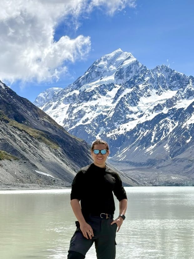
Mount Raung, one of the most formidable volcanic peaks in Indonesia, is located in the eastern part of Java near the Banyuwangi region. Rising to an impressive 3,344 meters (10,971 feet) above sea level, it boasts one of the largest and most dramatic calderas in Indonesia.
This stratovolcano is part of the Ijen Plateau and is recognized as the most challenging hike in Java (And even Indonesia). Unlike Mount Rinjani, there is no blue crater lake visible from the summit. For this reason, Mount Raung is not as commercialized or popular compared to Mount Rinjani.
The Hike: A Brief Overview
Mount Raung’s appeal lies in its thrilling ridge-top trek and extremely challenging terrain. The highlight of the hike is reaching the summit rim, where hikers are rewarded with panoramic views of the 2-kilometer-wide caldera, frequently shrouded in mist.
The hike to Mount Raung is not for the faint-hearted. It’s best suited for experienced hikers or those with a high level of physical fitness. The trail demands endurance, courage and the ability to navigate steep, rocky ridges that have high degree of exposure. The elevation gain for this hike exceeds beyond 2500m over 2 days, so it's ideal to have prior experience of hiking Indonesia volcanoes of similar intensity (Think Mount Agung in Bali, or Mount Rinjani in Lombok).
Although lower in altitude compared to Mount Rinjani, the volcanic terrain on Mount Raung is not to be underestimated, as the summit attack mandates all climbers to wear safety equipment, including helmets and harnesses. The trail towards the summit is also extremely exposed, and a small misstep can send you further up past the summit into the heavens.
Hiking Options
There are mainly 2 options for climbing Mount Raung:
- Summit via Kalibaru Route (Covered in this article): The direct path to the actual summit (Puncak Sejati, 3344m), requiring climbing ropes, helmets and harnesses to complete. This path is usually completed over 3D2N, but can be done within 2D1N, which is what we went with for this climb
- Raung Crater via Sumberwringin: A longer route with more gradual ascents that leads climbers to Puncak Sumber Wringin, the edge of the crater rim (3180m). No technical climbing skills needed for this option, and the hike can be completed in 2D1N.
Ideal Time to Hike
The best time to hike Mount Raung is during the dry season, from April to October, when the trails are more stable, and visibility is optimal. The rainy season (November to March) brings slippery paths and increased risks of landslides.
Getting There
Mount Raung is accessible from several nearby towns, with the primary entry points being Banyuwangi, Bondowoso, or Jember. If you're coming from abroad, you can fly into Banyuwangi Airport or Surabaya’s Juanda International Airport. If not, arriving by train is also a scenic and cost-effective alternative.
I would highly recommend booking the hike with a tour agency, as they usually offer direct and private transportation to Mount Raung from the airport. Tour agencies also manage admin overhead for you, such as the application of permits and a mandatory pre-hike health check which will minimize the hassle of planning.
Agency shoutout
For this trip, we booked our tour with B3 Tour and Travel Bws, who made our experience hassle-free. The agency facilitated everything for us, from permits and transport, down to our meals. Our driver was responsive throughout the trip and ensured our safety as well.
Our hike was facilitated under Mount Raung Base Camp Bu Soeto, and this was taken care of by B3 Tour and Travel Bws as well - All we had to do was show up. If you're considering a hike to Mount Raung, B3 Tour and Travel Bws is an agency I would certainly recommend.
Day 1 - Arrival and Journey to Kalibaru
We arrived at Juanda International Airport, where we met up with Benny, our driver from B3 Tour and Travel BWS. Our homestay for the night is situated right in the heart of Kalibaru village, and is just a short distance from Basecamp Resmi Pak Eko Raung where we would be having our hike briefing the next morning. The drive would take around 6 hours, so we took the chance to rest up.
Prior to arriving, we stopped by a local clinic for a pre-hike evaluation. We were asked basic questions about our health and were required to provide declarations about any pre-existing health conditions. I was even questioned if I had gone on similar hikes exceeding 3000m elevation in the past before.
We then continued our journey towards Kalibaru, passing by hilly areas and agriculture fields.

Open fields en route to Kalibaru
Soon enough, we got a decent view of Mount Raung in the distance towering above the clouds.

Mount Raung in the distance
Kalibaru Homestay
We arrived at our Homestay for the night at around 4:30PM, and got settled in. Living conditions were not tiptop although understandably, we were in a relatively remote village far away from commercial hotspots.
Our guides served us dinner at around 6PM - A simple fried rice dish topped with eggs and chicken shreds.

Our dinner
We were then introduced to our guide for the climb, where we were given a quick brief on the hike and what to expect.

Briefing by our guide in our homestay
Then we spent the rest of the evening making our final preparations for the climb, like filling up our water, organizing our belongings and making sure we got all the items and equipment we need. We had to be up early for breakfast at 6:30AM the next day, so we turned in early.
Day 2 - Start of hike to POS 7 (Base Camp)
We got up early and had our breakfast - Another plate of rice with eggs and chicken. The portion was huge and we weren't complaining since we'd probably need the energy.

More rice and eggs
Official Hike Brief
We were transported nearby via motorbike to the Mount Raung information center for an official hike brief by an official. We were seated among other hikers who planned to climb the mountain as well. It was all in Bahasa so I didn't understand a thing, but our guide translated the essential parts for us.


Official hike brief
There was also a simple infographic to outline the hike to the summit:

Hike infographic
Journey to Pos 1
Our journey began on a 45 minute motorbike ride which transported us from the information center into the forests and eventually Pos 1, which serves as the official start point of the hike.

Motorbike ride to POS 1
The ride itself brings some thrill as we zipped through extremely narrow dirt roads, low-lying branches and uneven terrain. My rider's hands even got numb from all the handling that he had to stop by the side briefly to recover. At Pos 1, there is a local shop there selling snacks and drinks for hikers' last chance to restock if needed.

Local shop at POS 1
Pos 1 - Pos 2
The journey from Pos 1 to Pos 2 (1446m) takes you around an hour - The ascent is gradual and takes you through a dense rainforest with a slightly muddy terrain.

Hiking to Pos 2
And after an hour of hiking, we arrived at Pos 2, which also has a shelter for climbers to rest:


Pos 2 (1446m)
Pos 2 - Pos 3
After a quick water break, we resumed our journey towards Pos 3 (1651m) and arrived within 30 minutes. The terrain between did not change much, with the ascent being gentle. Like Pos 2, there is also a shelter at Pos 3:

Pos 3 (1651m)
Pos 3 - Pos 4
We arrived at Pos 4 (1855m) after another 40 minutes of hiking. Although the terrain wasn't as gradual, it was still manageable.

Pos 4 (1855m)
It is also possible to set up camp here for the night since there's enough flat ground around. We decided to have lunch here so our guide pulled out our lunch from his backpack - Delicious local Indonesian food topped with tempeh:


Having lunch at Pos 4
We took our time to indulge in our lunch, which was packed with lots of rice and was more than enough to fill our appetite.
Pos 4 - Pos 5
After our lunch, we continued on our way to Pos 5 (2115m) and arrived in about 30 minutes. From here on, we observed that vegetation became more sparse and we could start to feel the wind.

Pos 5 (2115m)
Pos 5 - Pos 6
From Pos 5 to Pos 6 (2235m), the terrain got noticeably steeper. Our legs started to feel the burn and we also spotted hikers taking breaks along the way. At some segments, ropes are attached for some support in ascending. The journey to Pos 6 took us around 30 minutes:

Pos 6 (2235m)
Pos 6 - Pos 7 (Base Camp)
The final segment of Day 1 hike ends at Pos 7 (2555m), where we would be spending the night. We took around 1 hour and 15 minutes to hike this segment, and was the most exhausting part of Day 1's hike. The terrain was steep throughout and my legs were burning by the time we arrived at Pos 7.
Pos 7 (Base Camp)
We made it to base camp at around 1:40PM, which was a good thing since that meant we had the whole day ahead to rest and recharge. Once our tents were set up, we got changed and were served a hot plate of noodles and a cup of coffee. This was perfect given the cooler temperatures up at altitude.


Refuelling in our tent
After cleaning up, we got some sleep in the tent while waiting for dinner. By 6PM, the sun has set and it was dark. Other hikers have also arrived and set up tent as well:


Base camp at night
The landscape did not disappoint as well - At that altitude, we were well above the clouds and the night sky was as clear as it could get:


Calm night sky at base camp
We were served dinner by our guides at 6:15PM - Lots of rice (again), but with delicious curry on the side:

Dinner is served
I would suggest going to the latrine area only if you need to, because it was filled with litter. Also, there wasn't much cover so if you need a poop, best bring a friend along to look out for you! I won't say touch on the smell - The latrine hole was awfully small, and it's not surprising to see misaimed waste ending up around the hole rather than inside it.

Latrine at base camp
The toughest has yet to come - We had to prepare for our summit attack the next morning, so we went to rest as soon as we were done with dinner.
Day 3 - Summit Attack
In all the hikes I've done - Mount Raung delivered the highest dose of adrenaline.
We started the morning with breakfast served at 2:30AM - A simple plate of rice:

Our breakfast
Base camp - Pos 9
The terrain from base camp onwards can't be compared to the day before - The gradient was extremely steep, with most steps requiring my knees to rise past my belly to proceed. We put on our headlamps and set off at around 3AM in the dark, arriving at Pos 8 (2876m) around an hour later at 4AM.

Pos 8 sign (2876m)
A quick break and we set off for Pos 9, which took us another 50 minutes.

Pos 9 (3070m)
Pos 9 is the last checkpoint you will be in hiking in vegetation. By the time we arrived, it was already 4:50AM and we could see the faint sunrise hues in the distance.


Sunrise hues at Pos 9
From here on, you will be navigating the ridge lines of Mount Raung where safety equipment is needed. Our guide geared us up with the harness and helmet, and we set off once everything was in place.

Guide setting up our safety equipment
Pos 9 - Puncak Sejati (Summit)
This summit attack serves as my most memorable one to date. Breaking through the vegetation revealed just how high we were - It was a surreal feeling knowing how close we were to the summit. From here, it was a 3 hour climb on one of Indonesia's most challenging climbs to the summit of Mount Raung.


Right after we cleared the vegetation
Advancing a little, and we were finally on the ridge line:

First steps on the ridge line
We were now at what's called Puncak Bendera, or Flag Peak. From here on, we wouldn't need our hiking sticks, and there is a small man made spot where hikers would leave their hiking sticks for the remainder of the hike, and collect it on their way back down later on.
The summit of Mount Raung was also in sight - Our guide verbally explained to us the few segments that had to be completed before we could reach the summit. It was at this point that adrenaline started to kick in as we questioned whether we would make it all the way up there in one piece. I've even read about hikers marking this as their end point as they had deemed the path onwards to be too technical or dangerous for them (I would advise to exercise your own judgement here).


Overview of the summit path from Puncak Bendera
Ridge line segment
The initial segment of the summit attack was straightforward - A careful traverse along the ridge line. There was a short segment requiring minor scrambling, but was overall manageable. Looking back, the sun had already risen above the landscape, and we could see the ridge line path we took on the way.


Ridge line path and the sunrise
Rock Face Climb via Harness

Rock Face Climb
This segment would be the most adrenaline-pumping part of the summit attack. You would have to be secured via your harness before traversing a near-vertical rock climb with almost nothing beneath you. Guides will be stationed to fasten the ropes for you and ensuring you ascend safely. Due to this minor logistical set up requirement, there was some waiting time.


Waiting for our turn to ascend
The good thing is that the climb is short, though a good arm grip strength will be helpful for manoeuvring this segment.

Navigating the rock climb
Once up top, you might get a good view of Mount Argopuro to the west, or Mount Agung in Bali to the east. Again, we got a clear view of the ridge line segment from earlier:

Ridge line segment
Narrow ridge line
There was a short ascent until we reached a narrower part of the ridge line. What's the big deal? This segment is so narrow that you'd have to be secured with a rope again while you walk the ridge line. Again, there was a short queue due to the logistical set up required.
By then, the sun had risen above Mount Raung and cast a beautiful silhouette over the horizon:

Silhouette of Mount Raung
Another shot while waiting:

Top down view taken while waiting
And it was finally my turn to cross the ridge line - At one point it got so narrow that I decided to slide across instead:


Crossing the ridge line: Before and during
Supported rope descent
After the narrow ridge line segment, there was a short but steep ascend to tackle, before we had to descend again. Again, ropes were secured. Although the descent was steep, it was relatively less intimidating as there are 2 rock walls beside you as you descent which provided some sense of support.

Rope descent segment
Filler segment
We then navigated through a series of varying terrain, like mini descents or crossings with ropes:


Navigating through the terrain
And not to mention, it was exhausting.


Just a bit more
Final ascend
The final segment of the summit attack is a brutal straight line uphill scramble with around a 400 meter elevation gain. With the fatigue built up, this ascend was not an easy one either and we stopped once or twice to catch our breaths. For this segment, full scrambling is needed at some points, like for this part when the next step forward was as tall as me (1.8m, or 5'10").

Steep final ascent
Puncak Sejati (3344m)

Summit sign
And we made it to the top of Mount Raung! The sense of achievement is indescribable given the challenges we overcame. Spend up to an hour here to celebrate the climb and take many photos to remember the moment.

At the summit, standing the edge of the caldera
The 2km-wide caldera is grand, and seeing it up close was surreal. On a good day, you can also see the summit trail from where you began:

Where we began the summit attack
Descent back to Pos 1
After satisfied with our photos and videos, we commenced our descent, going back down the same path. The descent was no easier than the ascent, which required us to navigate the same challenging terrain we passed on the ascent.
We arrived back at Pos 7 base camp at around 2pm and had our lunch immediately, prepared by our guide. If you're hiking over 3D2N, this would conclude day 2, where you rest for the day and commence the descent back to Pos 1 the following day. Since we opted for 2D1N, we commenced our descent immediately and arrived back at Pos 1 at 4:50 PM. We had to wait for our motorbike riders to come to fetch us back on the same 45 minute ride back to Kalibaru village. We washed up at our home stay and had dinner prepared by our hosts.
Closing Thoughts
If you're a thrill seeker, Mount Raung is the peak to bag. The hike is not easy at all, and some training is definitely recommended. Although the summit trail is highly exposed, it is still manageable as long as you tackle the obstacles confidently. Plus the reward that comes with reaching the summit is extremely worth it knowing that you conquered Java's most technical volcano climb. This climb is comparable to the likes of Mount Rinjani, although Mount Rinjani is less technical (no harness needed).